Korlai Fort and LightHouse

Korlai Fort
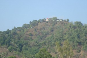
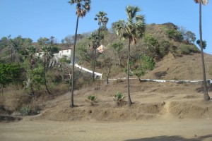
Korlai Fort was built on an island (Morro de Chaul) which guards the way to the Revdanda Creek. It was meant as a companion to the fort at Chaul. At this strategic position the Portuguese could use it to defend their province which stretched from Korlai to Bassein. Vestiges of the Portuguese occupation are manifested in the distinct dialect of the Korlai villages inhabitants which is a Luso-Indian Portuguese Creole called Kristi.
The fort is 2828 feet long, and its average breadth is eighty-nine feet. The enclosing wall is 5′ 3″ high and has 305 battlements for guns. It is entered by eleven gates – four are outer and seven are inner. At the north point, within pistol-shot of main battery is the water cistern named Santa Cruz – major source of water. The area within the fort walls is divided into three enclosures by two lines of bastioned fortifications. Each of the seven bastions bears the name of a saint. The two westward bastions are named São Diego(after Didacus of Alcalá) and São Francisco (after Francis of Assisi). The others are São Pedro, São Inácio, and São Filipe.

Korlai Fort Front View
The top of the hill is bastioned as well and is and surrounded by a parapet. It has a large rain-water cistern with three mouths, each one foot wide, and the ruins of the magazine and a church. The church was built in 1630 for the use of the army and was functional until 1728.
There are three Portuguese inscriptions. One, over a doorway in the centre and highest part of the fort (see picture), reads as follows:
This castle was commanded to be built by the Viceroy of India Dom Filipe Mascarenhas in November of the year 1646 and Fernão Miranda Henriques being Captain of Chaul, and was finished in May 1680, Cristóvão de Abreu de Azevedo being Captain of this fort.

Korlai Lighthouse
The inscription is surmounted by a cross with a coat of arms having the Portuguese stars in the centre and surrounded by seven castles. Other inscriptions over the main entrance and over an altar in the chapel are worn out and undecipherable. During the brief Maratha rule, some of the names of the bastions were changed but now the only indication of their presence is some dismantled shrines.
The Korlai Fort lighthouse was commissioned in 1955 soon after India gained independence. The lighthouse tower was built on the small island to help ships navigate.
Khandheri Lighthouse and island

Khandheri Island
The Khanderi Fort which is also an important place in Alibaug is situated on a lone island and hence tourists can visit this place again through ferry fishing boats. The fort is situated at about 3.5 kilometers from Thal beach. The fort was constructed in 1678. Later a lighthouse was constructed next to the fort to beacon ships that traverse around the sea and wish to drop anchor along the coasts. The British tried all they could to secure position of the boat but were rendered unsuccessful.
However the British finally captured the fort in the year 1750 as part of the Peshwas territory. The British laid capture and control and ruled over the territory for long and was a strategic points for the British Presence in Alibaug. Soaked in the years of heritage this fort offers tourists an environment of peace serenity and also a perfect place to spend time in quietude and serenity.
In 1852, a beacon was constructed on Khanderi island but had to be demolished immediately due to its similarity to the Colaba lighthouse. The work on construction of the new 17 metre high octagonal masonry light house began in October 1866 and the light was first lit in June 1867. The initial large wick lamp and optic assembly was supplied by M/s Chance Brothers, Birmingham. In 1930, the wick lamp was replaced by a PV burner.
There is also a fort on the island, built by the Portuguese and later occupied by the Marathas. Kanhoji Angre took command of the Maratha Navy in 1708 and won a number of sea battles till his death in 1729. Khanderi island was renamed in his honour in 1998 on the occasion of the Quasquicentennial (125th ) Anniversary of the Mumbai Port Trust.
Underi Fort
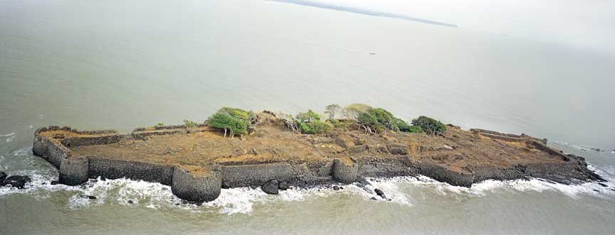
Underi Fort
About a Kilometer away from Khanderi, this is another island fort built by Siddi Qasam in 1680. Supremacy over this fort kept shifting between the Siddis, Peshwas, Angres and later the British. One can visit this fort with permission from the Bombay port trust. Local fishing boats can be hired for a visit.
Datta Mandir ( 3 Km )
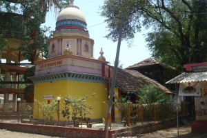
Historical Dattatraya temple on hill in Chaul village. Has about 750 properly built steps. Can be approached from Hingulja devi mandir side. Hingulja devi temple is on a smaller hill and has 120 steps. From hingulja devi there is mountain path leading to Datta mandir. This is much simpler than climbing 750 steps of Datta mandir mountain. Take road via Hingulja devi for going to Datta mandir and come down by steps. This will be about 4 hours outing and reasonably strenuous.
A five days Yatra ( fair ) starting from Datta Jayanti day is a very important event for locals and for surrounding villages. The season during the period is very pleasant. The whole atmosphere is charged with yatra fever. This is some event every city dweller must visit once in a life time and enjoy the Yatra feel.
Daily Market
Typical village market near Maruti temple is a very interesting place to visit where fresh local farm produce are sold in the morning between 9 & 12 hours.
Fish Market runs in the mornings and evenings depending on the tide timings. You can have sea fresh seasonal catch.
Hingulja Devi ( 3.5 KM )
This temple is run and maintained by Bhansali community is situated on a hill which is a southern part of Datta mandir hill. 120 well built steps reach this temple. There are three temples and few other utility buildings. Bhansali community celebrates the temple festival annually on “ Paush Pornima day ”, the night fire works and a fair is attended by a large number of villagers & followers.
Sheetala Devi ( 3.5 KM )
Very old temple of Sheetaladevi, built by Peshawas & Angre families is a Gavdevi for locals. Renovated in 1997, this is a most important Gavdevi worshiped by all casts and religions. Tuesday and Fridays are special days for pooja. This temple is situated in the lush green coconut and supari plantations of Chaul. The road passes through plantations on both sides and journey itself is very pleasant. You can walk through plantations or go by car or riksha.
Rameshwar Mandir ( 1 KM )
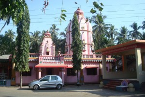
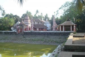
Shankar temple in Chaul is an excellent specimen of Peshawa time architecture.
Pushkarani ( temple lake ) in front is full throughout the year. It is a enjoyable swimming pool in monsoon season.
All through the year temple festivals are celebrated with great enthusiasm.
Birla Mandir ( 4.5 KM )
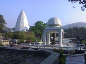
Built by Grasim group near Vikram Ispat factory. This is a Ganesh temple of very modern architecture in white marble, situated on a small hill ( 130 easy steps ). This is a place visited by tourists from all around. The entire hill is a temple complex with beautiful gardens & fountains all around.
Visit this temple in the evening and enjoy the whole complex in floodlights. Temple is closed between 11 AM to 4 PM. Camera is not allowed.
Revdanda Harbor and nearby Beach ( 1 KM )
It is a very scenic spot whereby you can spend some time on way to Birla mandir. One Km. long bridge spans the Kundalika river which joins Arabian sea at Revdanda. You can have a nice view of Korlai fort, Revdanda fort, and curve in the sand leading to Revdanda beach and open sea.
You can watch fishing trawlers & iron ore barges going out or coming in from the sea. If you are a fishing fan, carry a hook & line. You can get some good catch from the bridge or from the rocks.
Revdanda Beach
This is a long stretch of over 5 KM of clean beach starting from Revdanda harbor with a green wall of coconut trees on Eastern side.
You get an excellent view of sun set with color play in the sky which lingers far beyond the actual sun set.
Revdanda beach is very safe for sea bathing, however, avoid going in the water during low tide.
Korlai village & Church ( 4 KM )
The village is populated by Roman catholic East Indians & local fishermen. Korlai has a rich historical background dating back to 300 years during Portuguese rule. A village church and adjoining convent school are in a typical rural setting and worth a visit.
Korlai has small section of beach with beautiful view of open Arabian sea.
Phansad Dam & reserved Forest ( 8 KM )
This is an earthen dam situated in the thick forest. Excellent spot for day picnic in all seasons, however more exciting during monsoon. Ideal place for forest lovers. Do visit Kajuwadi village to get a real village feel.
Nagaon Beach ( 10 KM )
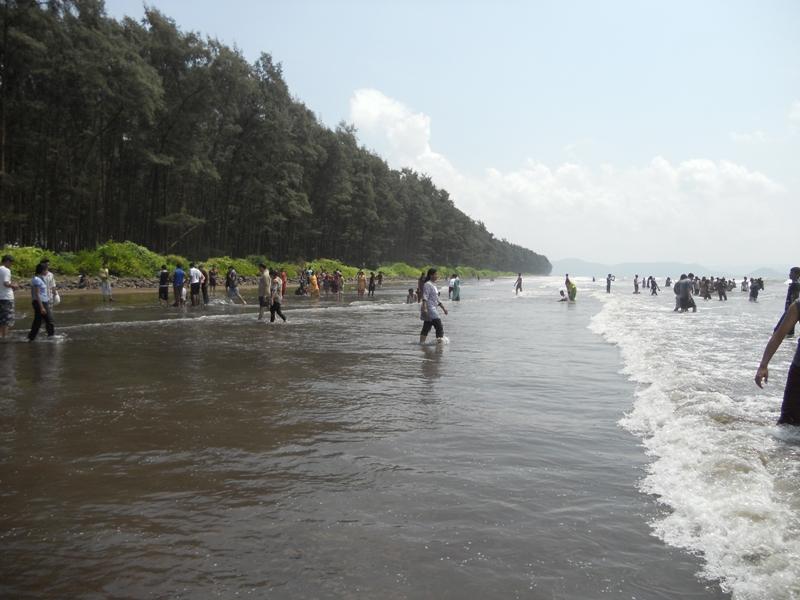
Kashid Beach
Nagaon beach is a flat clean stretch of sand with clear water and plantation of tall “suru” trees. Ideal spot for short or a day long outing.
Kashid Beach ( 17 KM )
Tiny stretch of beach on way to Murud. Popular due to vicinity of Suman motel resort.
Popular sto over on way to Murud
Siddhivinayak Temple at Nandgaon ( 23 KM )
A very famous Ganesh temple in Nandgaon – on way to Murud – is surrounded by lush green coconut and supari plantations
Beth El Jewish Synagogue
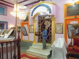
Beth El Synagogue is located in chaul region one of village of Maharashtra India called Revdanda.
It is almost 100 years old synagogue which was build in the locality where largest Jewish Population lived. This synagogue is konkani style of synagogue different than other synagogues around the world. Location is within the place where there is coconut trees around. It has a special women’s Gallary on the top and also its structure is different and very unique.

